

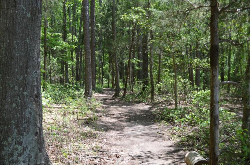
Project Area
 The Latta Nature Preserve, covering approximately 1,460 acres, is Mecklenburg County's largest of 27 nature preserves, each with a diverse array of management and recreational activities. Latta's green peninsula extends into Mountain Island Lake and protects a natural heritage site and several endangered plants. The Preserve contains both developed parks, undeveloped natural areas, and numerous riparian and floodplain habitats.
Management Goals

This adaptation plan focused on the forested areas in Latta's Natural Resources Management Plan. Major goals and objectives in the riparian areas focus on aligning trails to minimize impacts to natural communities and sensitive species; and strategically acquiring parcels to expand the buffers around nature preserves. The overarching goals in the park areas include enhancing structural diversity through the establishment of canopy gaps and the perpetuation of a variety of successional stages; and controlling the spread and establishment of invasive species through systematic inventory, treatment, and monitoring.
Challenges and Opportunities
Climate change will present challenges and opportunities for accomplishing the management objectives of this project, including:
Challenges
Timber operations are performed in parts of the preserves outside of public viewing and may be restricted due to reduced areas for extraction and change in public perception.
Invasive species like Autumn olive and Japanese stiltgrass are pervasive throughout the preserve.
Increasing weather variability will constrict window of opportunity for prescribed burns during late Winter, early Spring (wetter).
The horse trails are already more prone to erosion and damage, and wetter conditions will make maintenance more challenging.
Private lands surronded the Preserve can serve as a source of invasive plant seeds.
Opportunities
Marketing strategies could effectively increase communication between the general public and the Preserve planning staff.
An increase in prescribed fire may reduce the risk of wildfire while also reducing some invasive plants.
The size of proposed burn areas can be reduced to accommodate shorter burn windows depending on suitable conditions.
New trail development or rerouting can incorporate low impact solutions to erosion and sedimentation
Private lands can serve as a buffer from development if they are maintained in a natural forested state.
Adaptation Actions
Project participants used the Adaptation Workbook to develop several adaptation actions for this project, including:
Area/Topic
Approach
Tactics
Parks
4.3 Restore or maintain fire in fire-adapted ecosystems.
Forest Strategy 1: Sustain fundamental ecological functions.
Forest Strategy 2: Reduce the impact of biological stressors.
2.3. Manage herbivory to promote regeneration of desired species.
Forest Strategy 1: Sustain fundamental ecological functions.
Forest Strategy 2: Reduce the impact of biological stressors.
2.3. Manage herbivory to promote regeneration of desired species.
Develop a strategic communication plan to build awareness and support of management activities such as prescribed burns.
Conduct relatively small prescribed burns over a longer burn season.
Research efficacy of an urban bow hunting program to minimize deer herbivory and protect tree plantings.
Riparian Areas
7.1 Favor or restore non-invasive species that are expected to be adapted to future conditions.
Forest Strategy 7: Promote landscape connectivity.
Forest Strategy 9: Facilitate community adjustments through species transitions.
6.2. Expand or buffer the boundaries of reserves to increase diversity
Forest Strategy 7: Promote landscape connectivity.
Forest Strategy 9: Facilitate community adjustments through species transitions.
6.2. Expand or buffer the boundaries of reserves to increase diversity
Target tree plantings in areas that do not meet SWIM buffer standards, especially near trails within the buffer zone.
Monitoring
Project participants identified several monitoring items that could help inform future management, including:
Forest assessment plots will be evaluated for reduction in invasive species by 50%.
A GIS database of stand-specific age classes will be updated.
Deer density will be estimated for reduction in deer to 15-20 per square mile.
Streams will be evaluated to compy with SWIM buffer guidelines.